About the exhibit · Location Analysis
localscope.pl - check the location before you sign the lease
A free tool that scores an address for your business in under a minute: real walking reach, residents, competition and a transparent 0-100 potential score.
Choosing premises is one of the most expensive decisions when opening a brick-and-mortar business - and one of the hardest to undo. A lease binds you for years, and gut feelings like "there's decent footfall here" can cost a fortune. That is why we built localscope.pl - a free tool that shows, in under a minute, what potential a specific address has for a specific line of business.
How does it work?
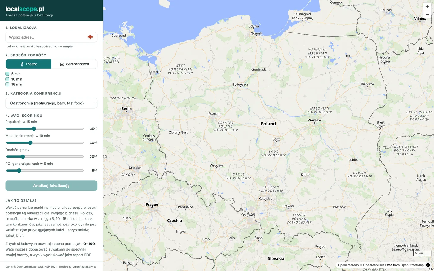
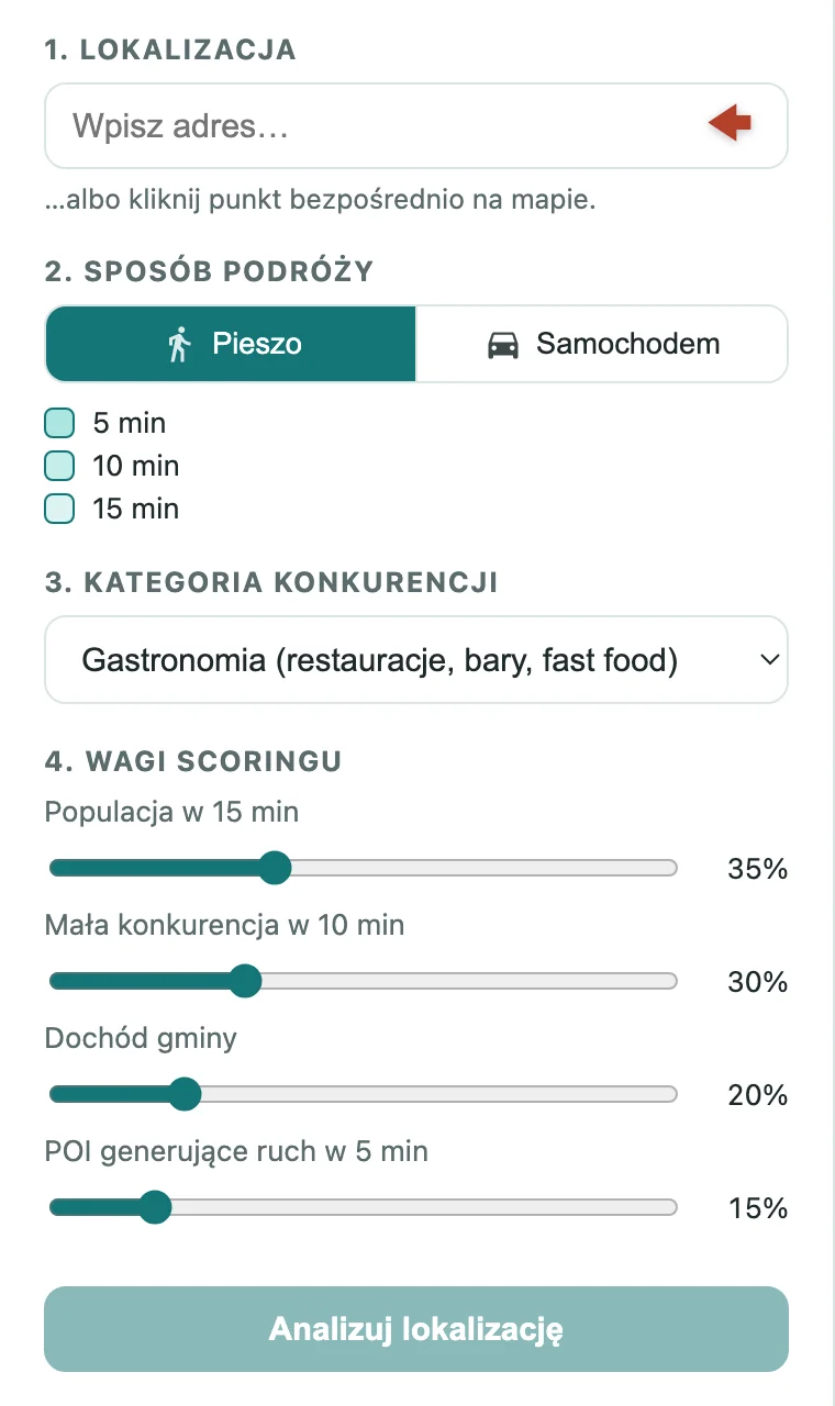
You type in an address or simply click a point on the map. You choose whether your customers will arrive on foot or by car, pick your industry - and click "Analyse location". Moments later you get a complete picture of the area.
Real reach, not a circle on a map
Most people think of a venue's reach as a circle: "customers within a kilometre". The problem is that nobody walks in a straight line. A river, a rail line, dead-end streets or a dual carriageway with no crossing can cut off half a neighbourhood.
localscope.pl draws zones of actual walking or driving reach in 5, 10 and 15 minutes, computed along the real street network. The map shows at a glance how far your venue truly reaches - and what you cannot see from the pavement.
What exactly are isochrones?
The zones localscope.pl draws are known in spatial analysis as isochrones - lines connecting points with the same travel time from a chosen place. A 10-minute walking isochrone covers everything you can genuinely reach on foot in 10 minutes: it accounts for pedestrian crossings, footbridges, bridges and dead-end streets. A driving isochrone factors in the road layout and the fact that a residential lane is slower than a dual carriageway.
Isochrones are a standard working tool of retail chains, urban planners and real-estate analysts - normally available in expensive, specialist software. In localscope.pl you get them for free, in seconds, with no expert knowledge required.
How many people live within reach?
For every zone the tool calculates the number of residents - not "roughly", but from population distribution data. That is the foundation of every decision: a bakery needs a few thousand people within a short walk, a gym - tens of thousands within a short drive.
Competition - including the niche kind
localscope.pl finds competing venues in the area and pins them on the map. There are ready-made categories to choose from (food service, hairdresser, gym, pharmacy, grocery store, café), but you can also define your own category - from a bakery to a tattoo studio - or simply type a chain's name, e.g. "Żabka", and see all of its locations within reach.
Every competitor is assigned to a specific zone: a rival 4 minutes' walk away is a different story from one at the far end of the fifteen-minute drive zone.
Area affluence and places that draw people
Two more factors enter the analysis. The first is the municipality's affluence - compared with the national average, because the same services sell differently in a wealthy suburban borough and in a poorer region. The second is places that draw people: bus and train stops, schools, universities, offices, shopping centres. The more such footfall generators around, the more people pass your window every day.
One number instead of ten tables
All the components converge into a 0-100 potential score with a clear label: weak, average, good, very good. The model is fully transparent - the report shows how many points came from population, how many from competition, affluence and footfall generators.
Crucially, you set the weights yourself, with sliders. Opening a neighbourhood café? Turn up the weight of the walking-distance population. A fitness club by a main road? Driving reach and low competition matter most. The score recalculates instantly, with no need to re-run the analysis.
A report ready to send
The result of the analysis is not just a map but a full report: metric cards for every zone (residents, area, competitors, footfall generators), a competition table with exact distances from your point, and the final score broken down into components. One click prints it or saves it as a PDF - a perfect attachment for a business plan, a loan application or a presentation for a business partner.
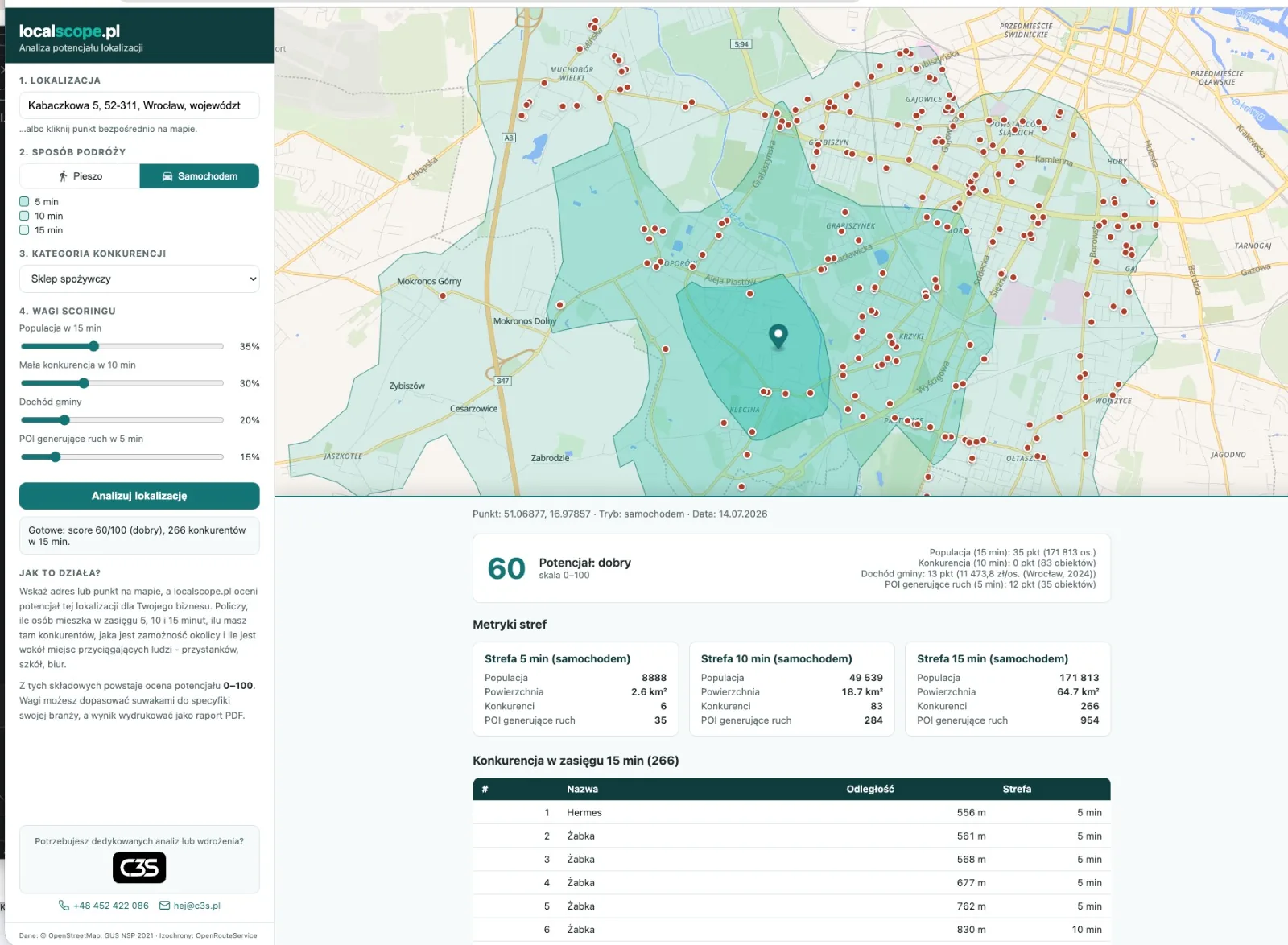
In the example above: a grocery store on Kabaczkowa Street in Wrocław, customers arriving by car. Over 171,000 people live within the 15-minute zone - but 266 competitors operate there too, hence the "good" score (60/100) rather than "very good". That is exactly the context you want to know before signing the lease.
Who is it for?
- Entrepreneurs comparing several premises before signing a lease,
- Franchisees and chains looking for white spots on the city map,
- Commercial real estate agencies that want to attach hard data to their listings instead of generalities,
- Loan advisors and analysts who need quick, objective location research.
Try it
localscope.pl runs in the browser, also on a phone - no registration, nothing to install. Go to localscope.pl, click a point on the map and simply see what the data says.
Need a version tailored to your company - analysing many locations at once, reports with your own branding, or integration with your sales data? We will build it for you. Get in touch - we design tools like this every day.
FAQ
Is localscope.pl free?
Yes. The tool runs in the browser, also on a phone, with no registration and nothing to install. You open it, click a point on the map and analyse.
How is the reach different from a plain circle on a map?
The 5, 10 and 15-minute zones are computed along the actual street network - on foot or by car. A river, a rail line or a dual carriageway with no crossing genuinely cut off part of the area, and you can see that on the map, unlike with an arbitrary circle.
What are isochrones?
An isochrone is a line connecting points with the same travel time from a chosen place. The 5, 10 and 15-minute zones in localscope.pl are isochrones - areas of real walking or driving reach, computed along the street network rather than as a straight-line radius.
How does the tool know how many people live within reach?
The number of residents in each zone is calculated from population distribution data, not guessed. On top of that comes the municipality's affluence compared with the national average.
Can I share the analysis with someone?
Yes - the result is a full report with metric cards, a competition table and the potential score, which you can print or save as a PDF in one click, e.g. for a business plan or a loan application.